This is a group of old photos of Huludao, Liaoning in 1935;, Mainly shot the historical features of the Republic of China in Xingcheng and Suizhong. This group of photos is from the Japanese magazineA Collection of East Asia Prints.
The issue date of the magazine in which this group of photos was published was April May 1935, so it is speculated that this group of photos may have been taken before April 1935.
The following photos are the old photos of Xingcheng series:
Xingcheng City, located in the southwest of Liaoning Province, the west bank of Liaodong Bay, and in the middle of the” Liaoxi Corridor “. The southeast is close to the Bohai Sea, the northeast is close to the Rehe Hill, and the southwest is separated by the Liugu River and Suizhong Counties face each other
![图片[1]-Old photos of Huludao in 1935 Xingcheng County and Suizhong County-China Archive](https://chinaarchive.net/photo/republic-of-china/1-220214230008.jpg)
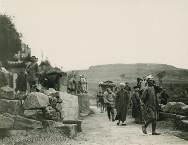
1935年,兴城郊外风光。
辽圣宗统和八年(990年),设兴城县(治所桃花岛郡今钓鱼台街道海口),这是兴城这一名称的最早由来。明,属辽东都指挥使司宁远卫,清代撤卫建州,1913年宁远州改为宁远县。1914年1月,因与山西、湖南、甘肃、新疆等省之宁远县重名,乃沿用辽时之名改称兴城县。
![图片[2]-Old photos of Huludao in 1935 Xingcheng County and Suizhong County-China Archive](https://chinaarchive.net/photo/republic-of-china/1-220214230009.jpg)
1935年,位于兴城南大街的祖氏石坊
祖氏石坊坐落于古城南大街(延辉街)中部,原有两座,相距85米。南为明前锋总兵祖大寿"忠贞胆智"坊,建于崇祯四年(1631年)。因有倒塌危验,1969年拆除,现已经修复;北为明援剿总兵祖大乐"登坛骏烈"坊,建于崇祯十一年(1638年)。两坊均为四柱三间五楼式,单檐庑殿顶,柱高楼小,雕饰细腻。
![图片[3]-Old photos of Huludao in 1935 Xingcheng County and Suizhong County-China Archive](https://chinaarchive.net/photo/republic-of-china/1-220214230010-51.jpg)
1935年,兴城古城的城内,城门楼巍峨完整,街道两旁店铺林立。
![图片[4]-Old photos of Huludao in 1935 Xingcheng County and Suizhong County-China Archive](https://chinaarchive.net/photo/republic-of-china/1-220214230010-52.jpg)
1935年,兴城温泉
兴城温泉在兴城市兴城河左岸阶地后缘,北近首山,南傍平原。出露点在铁路疗养院北院,前临兴海路,后濒首山河,西北至兴城古城约2.5公里。地理座标为东经120°44′,北纬40°37′。古称“汤池”,又称汤泉。
以下照片为绥中系列老照片:
绥中古称杏林堡,明宣德三年(1428年),改为广宁前屯卫,中后千户所;绥中县是环渤海经济圈的重点城市,辽宁省五点一线环渤海开发战略起点城市,辽宁沿海经济带重点支持区域 。
![图片[5]-Old photos of Huludao in 1935 Xingcheng County and Suizhong County-China Archive](https://chinaarchive.net/photo/republic-of-china/1-220214230009-50.jpg)
1935年,绥中,在地下挖成仓库,放入一筐筐的鲜梨进行贮藏。
![图片[6]-Old photos of Huludao in 1935 Xingcheng County and Suizhong County-China Archive](https://chinaarchive.net/photo/republic-of-china/1-220214230009-51.jpg)
1935年,绥中老县城的城墙,始建于明宣德三年。可以看到此段城墙虽有损坏,但大体完整,实属难得。
绥中:“绥”是安定平静之意,“中”是截取中后所首字,绥中合并起来为永久安定的中后所。
![图片[7]-Old photos of Huludao in 1935 Xingcheng County and Suizhong County-China Archive](https://chinaarchive.net/photo/republic-of-china/1-220214230010.jpg)
1935年,绥中县城的南门城楼。
![图片[8]-Old photos of Huludao in 1935 Xingcheng County and Suizhong County-China Archive](https://chinaarchive.net/photo/republic-of-china/1-220214230010-50.jpg)
1935年,绥中县城的城墙和城内民宅
![[Qing Dynasty] British female painter—Elizabeth Keith, using woodblock prints to record China from the late Qing Dynasty to the early Republic of China—1915-China Archive](https://chinaarchive.net/wp-content/uploads/2022/11/image-191x300.png)
