Share a group of 1870s“ East Zhejiang Portal” The old photos of Zhenhai, Ningbo, show us the old photos of Zhenhai City Gate, Zhaobao Mountain, Haiphong Cannon and other places 150 years ago
Zhenhai District is subordinate to Ningbo City, Zhejiang Province. It is located in the northeast of Ningbo City, the middle of the coastline of Chinese Mainland, the southern part of the Yangtze River Delta, and the coast of the East China Sea. The east screen Zhoushan Islands, west of Ningshao Plain, south of Beilun Port, north of Hangzhou Bay, and Shanghai are a strip of water
Zhenhai has a long history. After the founding of the State of Yue at the end of the Spring and Autumn Period, its territory began to belong; In the 25th year of the reign of Emperor Yingzheng of the Qin Dynasty (222 B.C.), Kuaiji County was set up and Jurzhang County was established; In the fourth year of Wude in Tang Dynasty (621), ancient sentences were analyzed and divided into Yao and Yin states. In the eighth year, Gengyinzhou became Mao County, which was renamed as the eastern boundary of Mao County. In the fourth year of the Tang Yuanhe era (809), Wanghai Town was built at the mouth of Yongjiang River in Maodong, which was the beginning of Zhenhai’s governance
In May of the third year of Kaiping in Houliang (909), Qian Liu, the king of Wuyue, visited Mingzhou and built the city in Wanghai Town; In the eighth month of the leap, Qian Liu set up Wanghai County (Taiping Huanyu Ji), the beginning of building the county, because Wanghai Town is located near the Haikou and has the advantage of fishing salt. It was almost changed to Dinghai County. In the 26th year of Kangxi (1687), Dinghai County was changed into Zhenhai County
During the Republic of China, the organizational system of Zhenhai County was restored in January 1963 due to frequent changes in its organizational system and county boundaries. In July 1985, it was incorporated into Ningbo again. In October of the same year, the county system was officially abolished and Zhenhai District of Ningbo was established
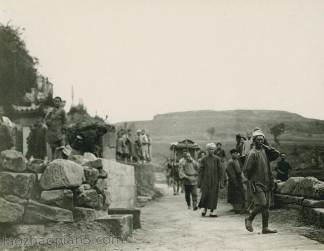
Let’s take a look at the Zhenhai style of Ningbo 150 years ago
分享一组1870年代“浙东门户”宁波镇海老照片,让我们见识下150年前的镇海城门城墙、招宝山、海防炮等地旧影。
镇海区隶属于浙江省宁波市,位于宁波市境东北部,中国大陆海岸线中段,长江三角洲南冀,东海沿岸。东屏舟山群岛,西连宁绍平原,南接北仑港,北濒杭州湾,与上海一衣带水。
镇海历史悠久,春秋末越国建国后,其地始有所归属;秦王赢政二十五年(前222年)置会稽郡,立句章县;唐武德4年(621年)析古句章,分置姚、鄞两州。八年,更鄞州为鄮县,本地改称鄮县东境。唐元和四年(809年),在鄮东甬江口建望海镇,为镇海建治之始。
后梁开平三年(909年)5月,吴越王钱镠巡视明州,筑城于望海镇;闰八月,钱镠因望海镇地滨海口,有渔盐之利,奏置望海县(《太平寰宇记》),为建县之始。未几改为定海县。康熙二十六年(1687)改原定海县为镇海县。
民国期间建制更迭与县境变化甚频,1963年1月恢复镇海县建制。1985年7月,再次并入宁波市,同年10月正式撤销县建制,建立宁波市镇海区。
让我们一起看看150年前的宁波镇海风貌吧
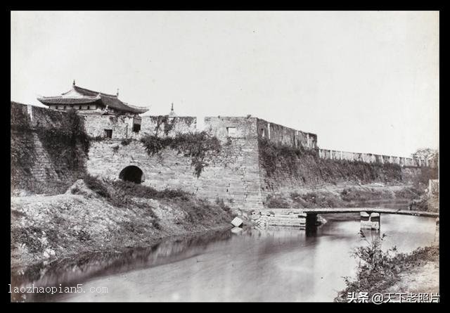
镇海北城门
雄伟的镇海城墙,简直是个天然的屏障,易守难攻之地。
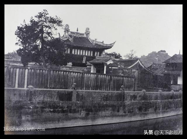
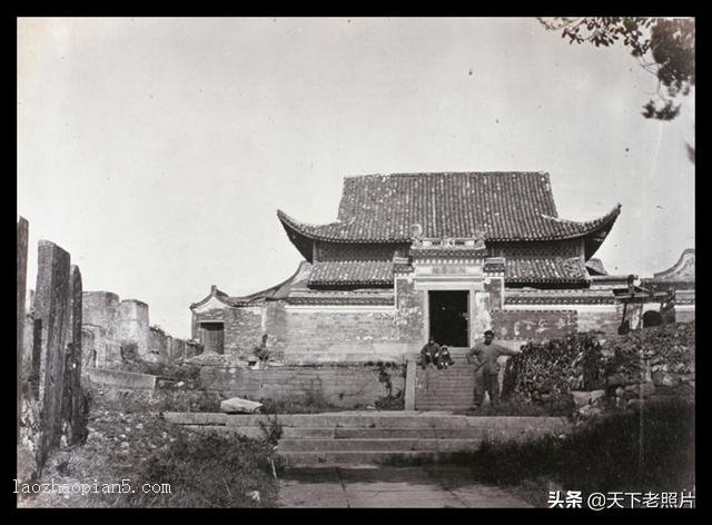
镇海文庙
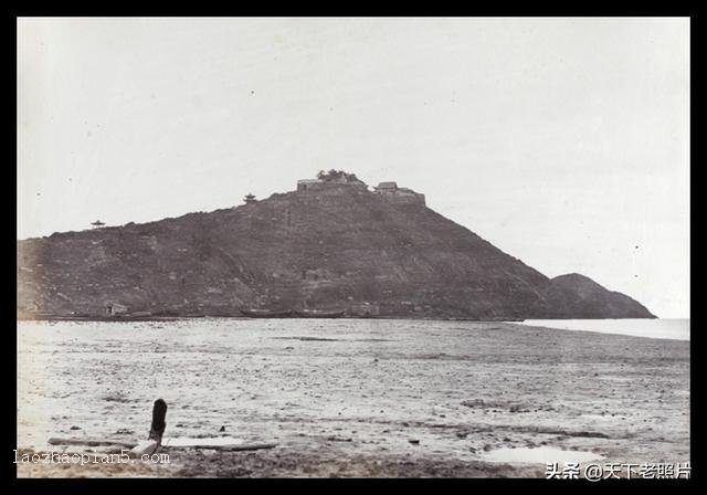
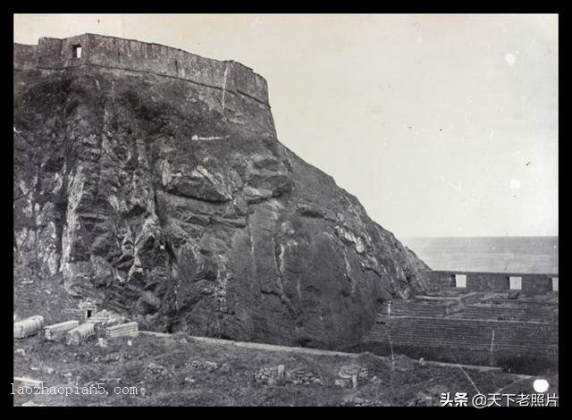
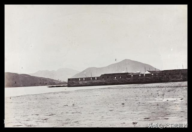
镇海招宝山
招宝山位于镇海城东北部,地处海口。山下的镇海港区,是一个著名的深水良港。招宝山与竹山对峙,大船在港口外不得并列而过,是天造地设的海防要塞。独特的地理位置,使这座海天雄镇经历了抗倭、抗英、抗法、抗日战争的硝烟洗礼。
镇海招宝山寺庙
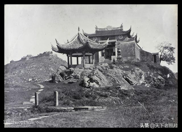
镇海招宝山山脚寺庙
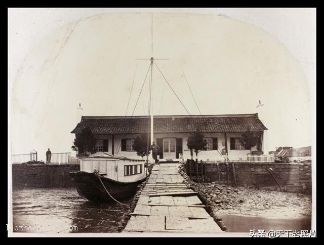
彼时的镇海海关
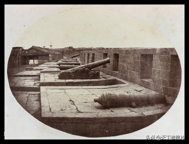
镇海的海防炮
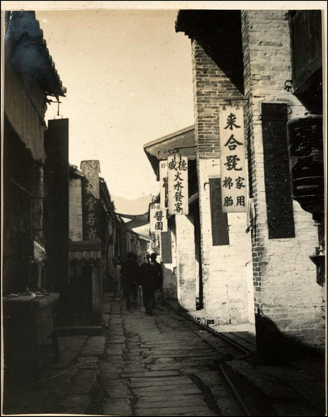
镇海石塘
![[Qing Dynasty] British female painter—Elizabeth Keith, using woodblock prints to record China from the late Qing Dynasty to the early Republic of China—1915-China Archive](https://chinaarchive.net/wp-content/uploads/2022/11/image-191x300.png)