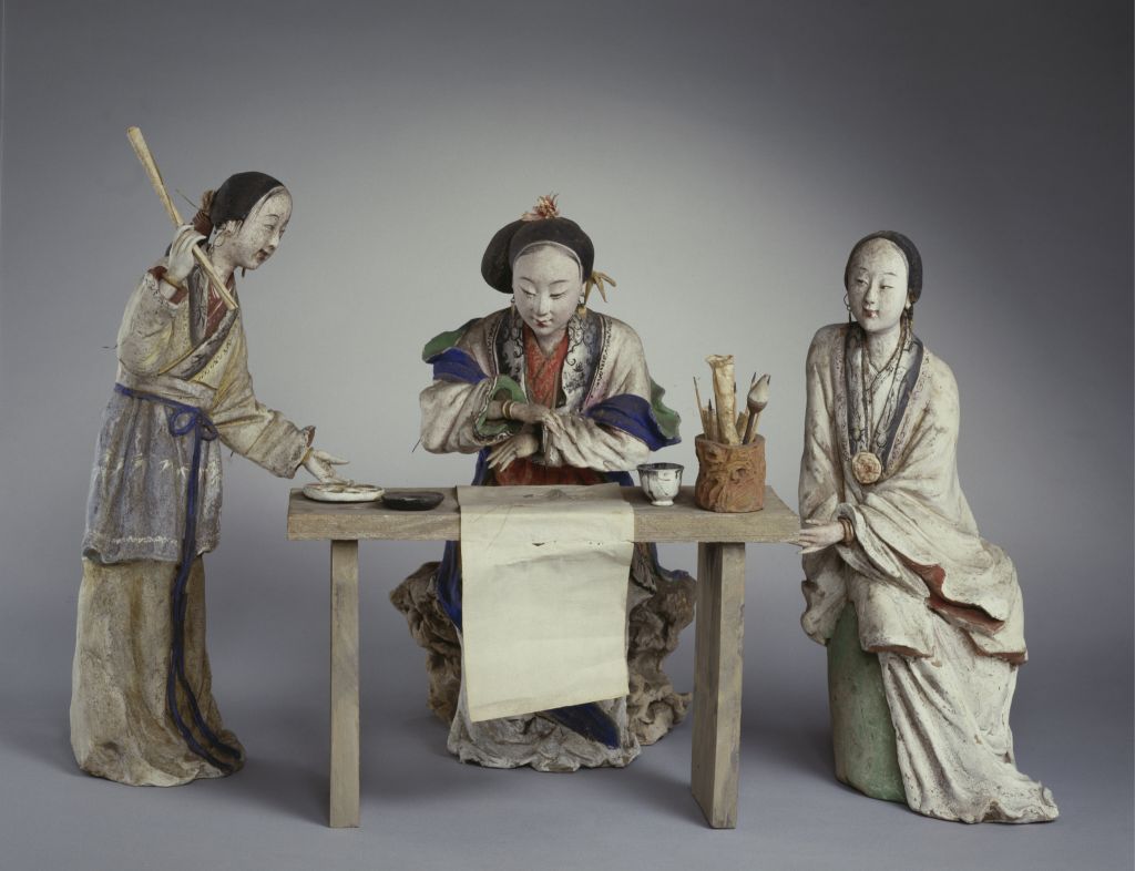
[Meiqing Mount Huangshan Map Axis]
Mount Huangshan Map Axis, Qing Dynasty, Meiqing painting, silk, color, 186.6 cm in length and 56.8 cm in width
The self-title of this painting is: “A path opens a dangerous sinus, and the cliff is ten thousand feet high. Every peak is lined with halberds, and every ridge is not flying. Flowers are folded with octopus branches, and clouds are deeply dyed with cloth robes. The sea gate opens in a magical place, only feeling the chemical work. The west sea gate. Qushan.” Seal “Qu Laoqing” Zhu Wenyin, “Tianyue Pavilion”, “Qu Xing” Bai Wenyin, and “Jingting Mountain and above the two streams” Zhu Wenyin
Draw the Xihaimen of Mount Huangshan Mountain. This picture is ingeniously conceived. The thousands of stone peaks from the bottom to the top, like halberds and swords, emerge from the clouds. They become the fulcrums of the huge cliff stones, stabilizing the picture, and the towering trend of the Xihaimen cliff stones is reflected by its curved and slender stone walls. In the picture, the outline of the mountain stone is outlined with thin lines, the stone surface is slightly haloed, and is decorated with smart ink points. Its simple color and ink, in addition to displaying the magnificent beauty of the mountain stone, make the pure and soft beauty of the mountain stone appear on the paper
![图片[1]-Meiqing Mount Huangshan Map Axis-China Archive](https://chinaarchive.net/Qing dynasty/painting/54883[1024].jpg)
![[Qing Dynasty] British female painter—Elizabeth Keith, using woodblock prints to record China from the late Qing Dynasty to the early Republic of China—1915-China Archive](https://chinaarchive.net/wp-content/uploads/2022/11/image-191x300.png)